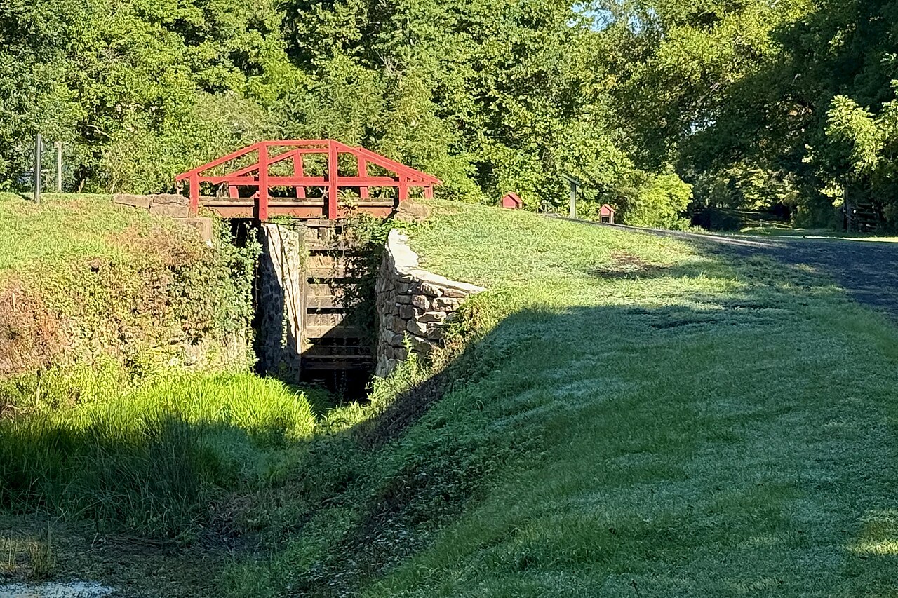
Black granite mile markers run along the east edge of the Delaware Canal towpath, set according to a 1964 canal survey. Lock 8 in New Hope is mile 24.01. Lock 13 at Point Pleasant is mile 32.363. Lock 19 at Upper Black Eddy is mile 41.756. Once you know that, planning a ride here stops being guesswork and becomes arithmetic.
The towpath
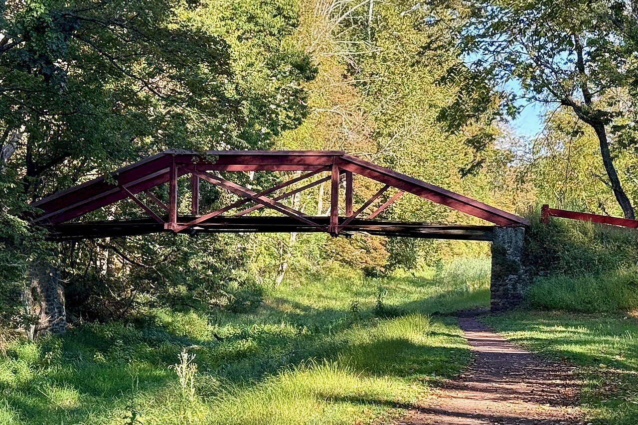
Delaware Canal State Park is a ribbon 58.89 miles long and rarely more than a few hundred feet wide, running from Easton down to Bristol and following PA Routes 611 and 32 for most of that distance. The park also takes in 11 river islands, including the Morgan Hill group, Loors, Whippoorwill, Old Sow and Raubs, plus the 50-acre Giving Pond.
DCNR rates the 59-mile Towpath Trail as easiest, point to point, with mile markers and ADA accessible surfacing. Trailhead amenities at access points include modern restrooms, potable water, picnic tables and benches, though those are clustered at the developed access areas rather than spread evenly. The towpath forms the Bucks County leg of the 165-mile Delaware and Lehigh National Heritage Corridor, and the D&L Trail it belongs to runs all the way from Wilkes-Barre to Bristol across more than 45 separate sections.
Park office: 11 Lodi Hill Road, Upper Black Eddy, PA 18972, 610-982-5560. The park is open every day of the year, sunrise to sunset. The Locktender’s House in New Hope is the historic education center and also serves as headquarters for the Friends of the Delaware Canal.
Surface, and what bike to bring
This is the part people get wrong. The towpath is crushed stone and packed dirt, not pavement. In good stretches it rolls like a fine gravel path. In others it is soft, rutted, root-crossed or washed to bare stone, and after heavy rain sections hold standing water and greasy mud for days.
Bring a hybrid, a gravel bike or a mountain bike with tires of at least 35mm. Road bikes on 25s are miserable here. Kid trailers work fine on the developed stretches near New Hope, Yardley and Upper Black Eddy and poorly everywhere else. Carry a spare tube and a pump, because there is no shop for 20 miles at a stretch.
Closures and detours, the thing to check before you load the car
The canal has been under near-continuous repair for two decades. Floods take out aqueducts and culverts, and the state rebuilds them one at a time, which means the towpath is almost never open end to end. DCNR states plainly that many areas of the towpath are closed for infrastructure improvement.
Two pages are worth bookmarking. The Friends of the Delaware Canal current conditions page is the fastest, most specific source, posting closures by mile post as they happen. DCNR keeps the official project maps on the park maps page.
To give a sense of what these look like in practice: recent postings have had the towpath closed at New Hope near mile post 23.7 at the Union Mills Bridge by the Water Works Condominiums, where deteriorating structure means debris can fall and riders have to turn around rather than pass under. Meanwhile the Upper Black Eddy section near mile post 44.27 reopened after culvert work on High Falls Creek in Bridgeton Township, and Lumberville near mile post 31.11 is open at the aqueduct pedestrian bridge. That mix is normal. Check before you go, every time.
Rides by distance
Distances below come off the Friends of the Delaware Canal landmark and mileage chart and the D&R Canal mileage table.
| Ride | Distance | Type |
|---|---|---|
| Yardley to Washington Crossing and back | About 9 miles | Out and back, family |
| New Hope to Center Bridge, Stockton, Lambertville, New Hope | About 8 miles | Loop, two bridges |
| New Hope to Washington Crossing and back | About 12 miles | Out and back |
| Point Pleasant to Frenchtown and back | About 15 miles | Out and back |
| Upper Black Eddy to Riegelsville and back | About 17 miles | Out and back |
| Easton to Bristol | About 58 miles | End to end, multi-day |
The short family ride: Yardley to Washington Crossing
Lock 5 in Yardley sits at mile 13.34 and the Route 532 crossing at Washington Crossing is mile 17.852. That is 4.5 miles each way on one of the flattest, best-maintained stretches in the park, with Washington Crossing Historic Park as a destination that actually gives kids something to look at. Park in Yardley Borough or at the historic park lot.
The classic loop: New Hope, Center Bridge, Stockton, Lambertville
The best introduction to the corridor. Start in New Hope at Lock 8, ride north on the towpath 3.7 miles to Center Bridge at mile 27.681, cross the Center Bridge to Stockton, New Jersey, then turn south on the D&R Canal feeder towpath. It is 3.9 miles from Stockton down to Lambertville, where the New Hope-Lambertville Bridge takes you back across. Total is roughly 8 miles with two river crossings and two towns worth stopping in. New Jersey’s towpath is generally smoother than Pennsylvania’s, so plan on the return leg feeling faster. Plenty more to do at the New Hope end is covered under our New Hope coverage.
New Hope to Washington Crossing
Mile 24.01 to mile 17.852, about 6 miles each way. Largely shaded, with river views through the trees on one side and the watered canal on the other. Worth pairing with our covered bridges guide.
Point Pleasant to Frenchtown
Lock 13 at Point Pleasant is mile 32.363. Lock 18 at Uhlerstown, opposite Frenchtown, is mile 39.97. That is 7.6 miles each way through the quietest, most rural stretch of the canal. The Uhlerstown-Frenchtown Bridge puts you in Frenchtown for lunch, and from there the D&R feeder towpath heads south if you want to keep going. This section is also where the towpath runs closest to the river and to the Point Pleasant tubing and kayak liveries.
Upper Black Eddy to Riegelsville
Lock 19 at Upper Black Eddy, mile 41.756, north to the Delaware Road bridge at Riegelsville, mile 50.34. About 8.6 miles each way, 17 round trip, and the northern end of the Bucks County canal. The park office is at this end, which makes it a convenient place to ask about conditions before you set out.
End to end
Easton at mile 58.88 to Bristol at mile 0.96 is roughly 58 miles. Riders usually break it into two days with an overnight around New Hope or Lumberville. Expect detours onto River Road or PA 32 around closed sections, some with traffic and no shoulder. This one needs real planning and a current closure map.
The New Jersey side
Most of the good loops depend on it. Delaware and Raritan Canal State Park carries more than 70 miles of linear multi-use path, and the feeder canal section that runs along the Delaware opposite Bucks County stretches 28.7 miles from Frenchtown south toward Trenton. Frenchtown to Stockton is 12.2 miles, Frenchtown to Lambertville 16.1, Stockton to Lambertville 3.9.
Bridges you can cross on a bike, north to south: Riegelsville, Upper Black Eddy to Milford, Uhlerstown to Frenchtown, Lumberville to Raven Rock (pedestrian only), Center Bridge to Stockton, New Hope to Lambertville, and Washington Crossing. DCNR counts five crossings that link the two towpaths into loops, and reckons eleven different loop combinations are possible.
Other Bucks County trails
| Trail | Length | Surface |
|---|---|---|
| 202 Parkway Trail | 8.7 miles | Asphalt, 12 feet wide |
| Tyler State Park bike trails | 10.5 miles | Paved multi-use |
| Nockamixon mountain bike trails | 10 miles | Unpaved singletrack |
| Nockamixon day use bike trail | 2 miles | Paved |
| Newtown Rail Trail (Northampton to Newtown segment) | 4.5 miles planned | Paved, 12 feet wide |
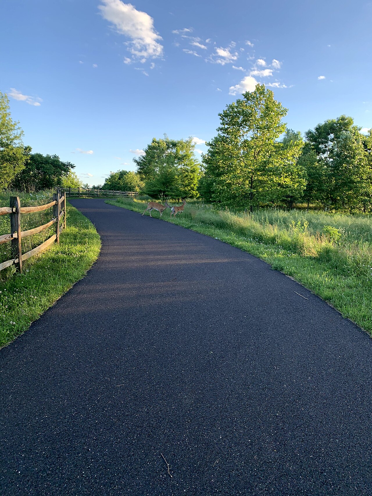
202 Parkway Trail. A 12-foot asphalt path beside the parkway, running 8.7 miles from Welsh Road in North Wales to New Britain Road in Doylestown, linking Montgomeryville, Warrington and Doylestown. Signalized street crossings and an overpass at Route 309. Fast, open, and the best option in the county for a road bike.
Tyler State Park. 1,711 acres at 101 Swamp Road, Newtown, PA 18940, 215-968-2021. Roughly 10.5 miles of multi-use paved trails wind through most of the park, with picnic tables placed along them for rest stops. Bikes are permitted only on designated paved trails, not on the hiking-only routes. E-bikes are allowed. The Neshaminy Creek cuts the park into sections, which makes the trail network more interesting than the acreage suggests.
Nockamixon State Park. A 10-mile mountain bike system sits on the east side of Haycock Cove, with trailheads off Tower Road, South Park Road and PA 563 and parking at the Tower Road and Haycock Boat Launch lots. DCNR warns the trail can be hazardous and slippery with steep, rough sections, and it closes in wet weather. There is also a gentle two-mile paved loop in the day use area.
Peace Valley Park and Core Creek Park. Both carry flat, easy bikeways around their lakes, good for a first ride with a child. Peace Valley is at 264 Creek Road in New Britain Township, Core Creek at 901 Bridgetown Pike in Langhorne. Details are on the Bucks County Parks and Recreation site.
Newtown Rail Trail. Still being built. The Northampton Township to Newtown segment is planned as a 4.5-mile linear park on a SEPTA right-of-way, 12 feet of paved trail inside a corridor at least 60 feet wide, connecting to the Circuit Trails network and the Neshaminy Greenway. Watch the Newtown Rail Trail site for progress.
Rentals and shops
Delaware River Pedal & Paddle rents towpath bikes at $40 for one day, $70 for two and $90 for three. That includes a helmet, a lock or lockable bag, a D&L Trail map and bike delivery. Pickup and drop points are Tinicum Park, Lock 19 at the park office, Riegelsville and Frenchtown, and they will deliver to local lodging if you arrange it ahead. Bikes come in three frame sizes.
On the New Jersey side, Pure Energy Cycling at 201 South Main Street in Lambertville rents standard adult bikes at $18 an hour or $60 a day and e-bikes at $25 to $28 an hour, $80 to $90 a day, with 24-hour advance reservations. Being in Lambertville makes it the natural starting point for the New Hope loop.
Prices change. Confirm before you book.
Practical notes
- Parking and access. Reliable lots exist at Tinicum Park, Upper Black Eddy near the park office, Point Pleasant, New Hope, Washington Crossing and Yardley. Street parking in New Hope and Lambertville is tight and metered.
- Restrooms and water. Modern restrooms and potable water are at developed access points, not along the whole trail. Between access areas you can go many miles with nothing, so carry water.
- Fees. There is no fee to ride the towpath and no permit required for cycling. Launch permits only come into play if you are putting a boat in.
- Day use only. The park is sunrise to sunset. No overnight parking or camping on the towpath.
- Dogs. DCNR requires pets to be physically controlled and attended at all times and on a leash, caged or crated. Electronic fences and leashes are prohibited. Leash length rules vary by park, so ask at the office. More in our dog-friendly Bucks County guide and on the DCNR pets in parks page.
- E-bikes. Permitted on state park roads and trails designated for biking, subject to DCNR e-bike guidelines. Ride at a sane speed. The towpath is narrow and busy with walkers.
- Flood and mud. The canal floods. After sustained rain, give the towpath two or three dry days before you ride it, and expect the low sections near aqueducts to be the last to drain.
- Riding with kids. Yardley to Washington Crossing, the Tyler State Park paved network and the lake loops at Peace Valley and Core Creek are the three best bets. All are flat, all have parking and restrooms, and none require a road crossing that will scare you.
What you are riding on
The Delaware Canal opened as a working freight route, mule teams walking the towpath hauling coal boats south from the Lehigh Valley to Bristol and on to Philadelphia. The path under your tires exists because mules needed somewhere flat to walk. That is why the grade is so gentle, and why the locks, lift bridges, aqueducts and locktender’s houses you pass every couple of miles sit in working order rather than as scenery.
It is the only remaining continuously intact canal of the American canal-building era, which is a big part of why it takes so long and costs so much to repair. The Friends of the Delaware Canal, headquartered in the Locktender’s House in New Hope, are the people who advocate for that work, publish the mileage chart and post the closure updates. They are worth supporting if you use the trail.
Once you are off the bike, our parks and trails guide and our town guides cover what is nearby, and the towpath also happens to put you within casting distance of some of the water in our Bucks County fishing guide.
Sources and Further Reading
- DCNR: Delaware Canal State Park
- DCNR: Delaware Canal Towpath Trail details
- DCNR: Biking at Delaware Canal State Park
- DCNR: Delaware Canal park maps and project maps
- Friends of the Delaware Canal: Current Conditions
- Friends of the Delaware Canal: The Towpath Trail and mileage chart
- DCNR: Tyler State Park
- DCNR: Biking at Tyler State Park
- DCNR: Mountain Biking at Nockamixon State Park
- DCNR: Pets in Parks
- Pennsylvania Trails Explorer
- Delaware and Lehigh National Heritage Corridor
- Delaware and Raritan Canal State Park
- Bucks County Parks and Recreation
- Newtown Rail Trail
- Delaware River Pedal & Paddle rentals
- Pure Energy Cycling, Lambertville
Trail conditions, closures and rental rates change, and the towpath in particular is under constant repair. Check the current closure and detour information with DCNR and the Friends of the Delaware Canal before you ride, and confirm rates with the shop before you book. Spot something out of date or wrong? Send us a correction and we will fix it.